


.png)


Projects and Initiatives
Public Works
Chamblee Dunwoody Road Georgetown Gateway
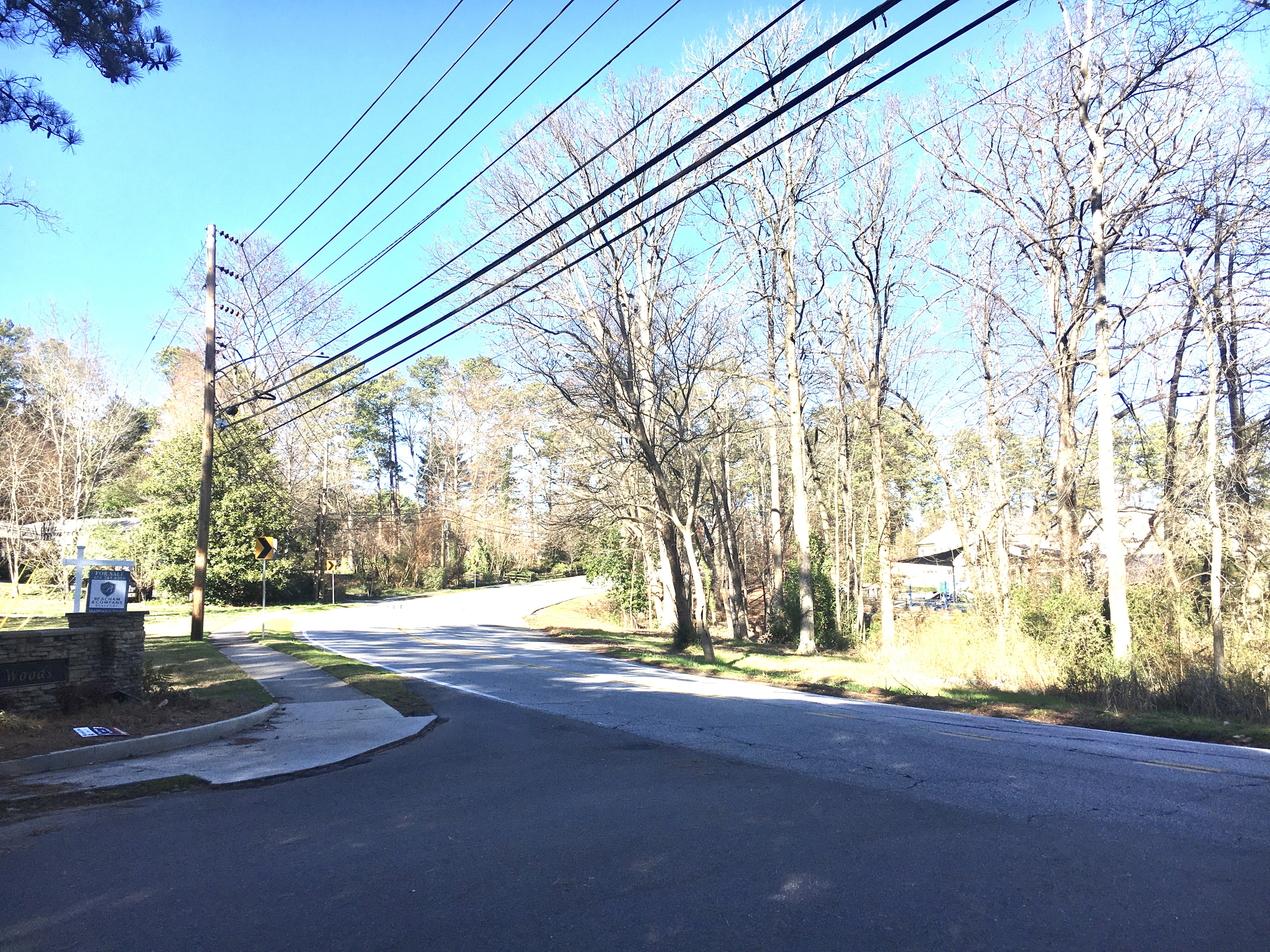
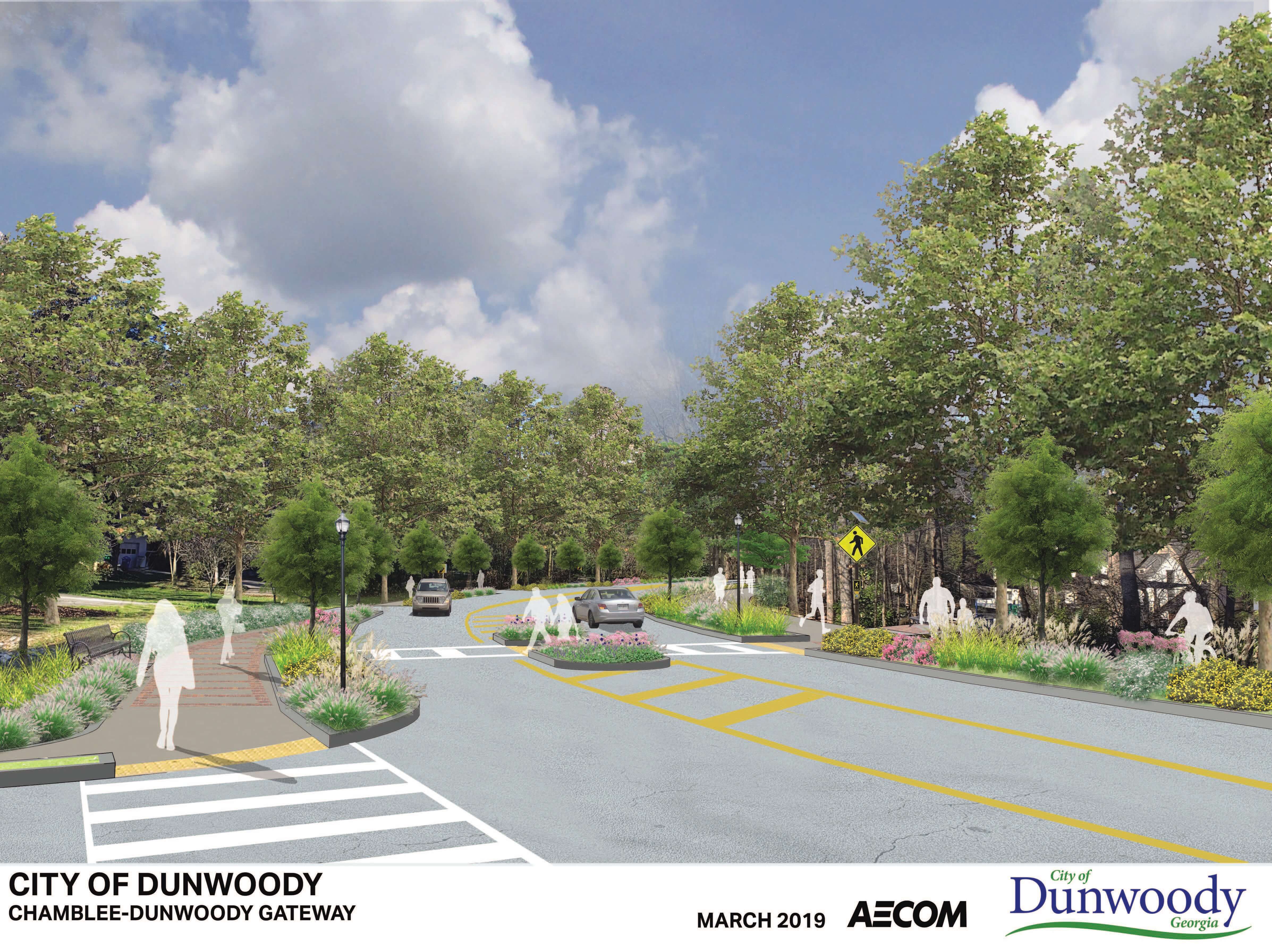
 The Chamblee Dunwoody Georgetown Gateway Project seeks to improve traffic flow and create a more welcoming environment for bicycle, pedestrian, and non-motorized users. The scope of the project entails creating a consistent streetscape that will enhance the visual appeal, walkability, and safety of the corridor. Streetscape elements will include items such as landscape buffers, street trees, pedestrian lighting, street furniture, bicycle facilities, and wider sidewalks.
This corridor has been identified in the city’s Comprehensive Transportation Plan as a high priority project. The focus of the upcoming construction project extends along Chamblee Dunwoody from I-285 to just south of the North Shallowford Road intersection. To provide an all-inclusive representation of the subject area, the conceptual design of future phases includes concept designs that extend through the intersections of North Shallowford Road/Peeler Road and Vermack Road. In addition, pedestrian improvements along Cotillion Drive between Chamblee Dunwoody and N. Shallowford Road have been proposed but are being deferred for the state's pending managed lane projects.
This segment of Chamblee Dunwoody Road is an important corrider for thousands of Dunwoody residents and provides access to over 13,000 vehicles travel each day. This project will provide non-motorized connectivity between the neighborhoods and nearby public parks and commercial amenities located along this corridor.
Current Project Phase – Utility Relocation
This project will require the relocation of several underground and overhead utilities. Utility relocations could take 24 to 30 months based on preliminary estimates from utility companies.
Next Project Phase – Construction
Construction is currently anticipated to begin in 2021 after utility relocation is well underway.
History
Public information meetings were held in December 2014. Based on comments received from the public and city council members, Alternate C was selected as the preferred alternate. This alternate provides a 12' wide multiuse trail on one side of the roadway and a wide sidewalk on the opposite side.
**User your cursor to move the arrows below left and write to see before and after images of the project.**
_20.PDF)
Responses to Public Comments
Georgetown Gateway (I-285 to Peeler) Combined Responses
Chamblee Dunwoody at Peeler Intersection to Vermack Combined Responses
Cotillion Multiuse Trail (N. Shallowford to Chamblee Dunwoody) Combined Responses
PROJECT DOCUMENTS
Contact
Public Works
678-382-6850
construction@dunwoodyga.gov