


.png)


Dunwoody Bicycle Network
The Dunwoody Comprehensive Transportation Plan outlines components of a Dunwoody Bicycle Network using the existing street system and proposed trails and off-street shared paths to create an interconnected system that allows for all types of users to safely and conveniently travel across the city.
On July 13, 2020, the Dunwoody City Council unanimously passed an ordinance that allows bicyclists of ANY age to ride on sidewalks in our city. The ordinance requires riders to be safe and yield to pedestrians. They must also give an audible signal before passing a pedestrian. Please note that this ordinance applies to skateboarders, too. Here’s a link to the ordinance to read more.
The Dunwoody Bicycle Network is a combination of on-street bike lanes, off-street paved trails, and adequate signage and road marking to encourage safety between vehicles, cyclists, and pedestrians.
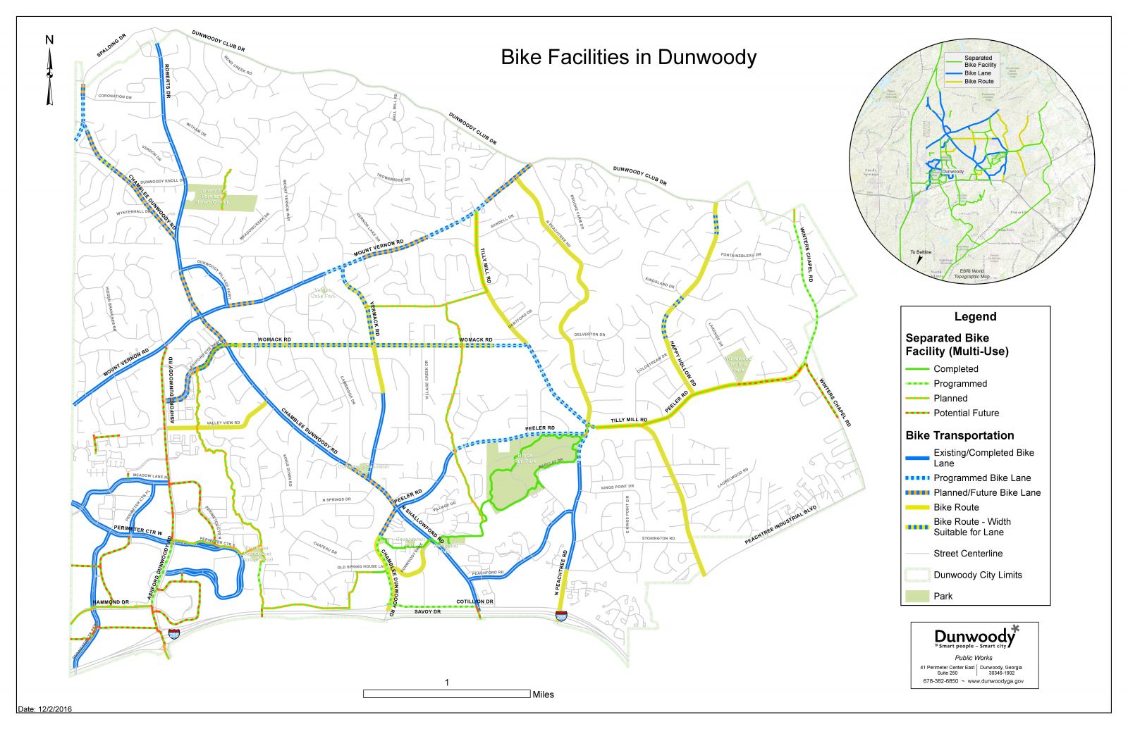
View a map of the current Dunwoody Bicycle Network.
The bicycle network aims to connect residents to destinations within the City and to other parts of the bicycle network, and although the aim is to provide additional connectivity throughout the City, the network will not connect every point within the City or seek to replace vehicle travel. Bicycles are legally allowed on City streets, and it is a reasonable assumption that experienced bicyclists will use the entire City street system to connect to places of destination.
The bicycle network should aim to connect less experienced and younger riders to places of destination within the City through safe and convenient means. Many factors were considered in determining the bike network and appropriate roadways and corridors to designate as bike facilities and bike routes. Bike facilities include on-street bike lanes or side paths adjacent to the roadways. Bike routes include signage and/or sharrows as an indication of the route. Facilities and routes were chosen to make connections between destinations within the City, including commercial areas, parks, schools, housing developments, and other City destinations.
Factors for Determining the Bike Network
- Facility user type: Skill level, type of user, and preferences of the user were considered to determine who would use the designated facility.
- Accessibility: Bike facilities should be located in areas and along corridors that are safe and convenient to access.
- Directness and connectivity: Bike facilities should provide the most direct and safe route to community destinations. Bike facilities should also connect to one another to create a complete and connected network.
- Conflicts: On-street bike facilities can introduce conflicts between bicyclists and motorists, while shared use paths can introduce conflicts between bicyclists and other type of users on the path, such as pedestrians and skateboarders. Driveways and intersections may also introduce conflicts for bicyclists.
- Maintenance: Facility design should consider maintenance and upkeep of the facility. Facilities should be designed for the simplest maintenance upkeep.
- Traffic volume and speeds: When considering on-street bike lanes and facilities, vehicle traffic volumes and speeds should be considered with the roadway width. This will contribute to identifying the bicycle user type and appropriate design, markings, and signage.
- Costs and funding: Decisions to implement the bicycle network need to consider design and long-term maintenance costs. Project facility selection should consider maximizing user benefit per dollar funded.
- State and local laws/ordinances: Implementing a bike network must be consistent with state and local regulations and should not encourage users of the network to engage in behaviors that are inconsistent with state and local regulations.